Lake Van’s shoreline and the mountains that surround it offer some of the most rewarding hiking in eastern Turkey. The landscape is huge and open: volcanic cones, deep valleys, ancient ruins, and a vast blue lake that changes color with the light. Trails range from gentle lakeside strolls to serious summit climbs, and most can be reached from the city of Van or the small towns around the shore. Because the region is remote and thinly populated, you will often have the trails to yourself. This guide covers the best routes, their difficulty, and what you need to know before you set out.
Why Lake Van Is a Hiker’s Destination
Hiking around Lake Van means walking through a landscape that few travelers ever see. The trails pass orchards and villages, climb volcanic slopes, and follow the shoreline of one of the world’s great lakes, so every day of walking brings a different view of the same vast blue water.
The region’s emptiness is part of its appeal. Outside the lakefront towns you may walk for hours without meeting another person, accompanied only by birds, wind, and the occasional shepherd moving a flock between pastures. The views are on a grand scale. From almost any hillside you can see the lake below, the snowy cone of Mount Suphan to the north, and on clear days the high peaks of the eastern ranges stretching to the horizon. This is hiking with an alpine feel and an inland-sea backdrop.
Around Van Castle and the Eastern Shore
The easiest walking begins in the city of Van itself. The castle hill, crowned by the ancient Urartian fortress, offers a short but steep climb that rewards you with panoramic views over the city, the lake, and the mountains behind it.
Below the citadel, a level path runs along the waterfront, past tea gardens and small beaches, and continues south toward the old Armenian church at Varak, tucked among orchards at the foot of the hills. This stretch is gentle enough for a family stroll.
For a longer day, follow shepherd tracks up into the hills behind the city, climbing through thyme-scented slopes to viewpoints over the entire basin. The walking is moderate, the air is crisp and thin, and the reward is a lake that seems to go on forever.
Because they begin at the city’s edge, they are perfect for your first day while you adjust to the altitude.

Mount Suphan: The Big Ascent
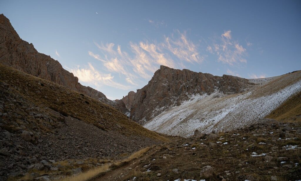
Mount Suphan, the volcano that dominates the northern shore, is the region’s classic summit challenge. At more than four thousand meters, it is one of the highest mountains in Turkey and a serious undertaking for fit, experienced walkers.
The usual route starts from the villages on the mountain’s south side and climbs through rolling pastures before crossing rocky slopes to the crater rim. There is no marked trail for much of the way, so a guide or clear route-finding skills are essential.
Most parties start before dawn, reaching the summit in time for sunrise views over the lake and the distant peaks of eastern Anatolia. The descent takes most of the day, and the loose volcanic scree demands care.
This is not a walk for beginners. You need proper mountain boots, warm clothing, plenty of water, and respect for the weather, which can turn violent at altitude without warning.
Mount Nemrut and Its Crater Lake
On the western side of the lake, the volcano Nemrut offers a completely different adventure. The mountain is a huge caldera, and its vast crater contains a small lake of its own, hidden from the outside world.
A rough road climbs toward the crater rim, and from there you can hike down into the caldera to the water’s edge. The terrain is dramatic: bare volcanic slopes, steaming fumaroles, and the silent, deep blue lake below.
The crater floor is scattered with small cones and craters formed by later eruptions, and walking among them feels like exploring another planet. The views from the rim across Lake Van far below are among the finest in the region.
The mountain is remote, and you will need your own transport or a guided day trip to reach the trailhead. Sturdy shoes and warm layers are essential even in summer, as the altitude keeps the air cool.
The Akdamar Island Circuit
The most popular walk near the lake is not a mountain route at all but a short circuit around Akdamar Island. After the boat crossing from the shore, you circle the island on a path that passes the famous Church of the Holy Cross and climbs to its high points.
The walk takes only an hour or two, but it is unforgettable. From the island’s rocky summit, the lake surrounds you completely, and the views over the water to the mainland and the snowy peaks are superb.
The path is easy and suitable for almost everyone, making it a wonderful choice for families or for travelers who want a taste of the lake without a long hike.
Allow extra time at the church to watch the light move across the carvings.
The Northern Shore Valleys
The northern shore of Lake Van, between the villages and the foot of Suphan, hides a network of green valleys that see almost no visitors. Streams descend from the volcano through orchards and hay meadows, and walking here feels like stepping back in time.
You can walk between villages on old farm tracks, passing stone houses, walnut trees, and fields where farmers still work with traditional tools. The people are welcoming, and a wave or a few words of Turkish go a long way.
The terrain is gentle by mountain standards, with steady climbs and descents rather than steep ascents, and the shade of the orchards makes it pleasant even in summer.
These trails are best explored with a local guide or a driver who can drop you at one end and collect you at the other, because public transport in the villages is rare.

The Southern Shore and the Bitlis Approach
The southern shore of the lake is quieter still, with the town of Tatvan anchoring its southwestern corner. From Tatvan, a walking route climbs into the hills toward the Bitlis valley, where the landscape turns to deep gorges and mountain pastures.
The area around the town of Bitlis, a short drive south, offers some of the most dramatic scenery in the region: steep canyons, rushing rivers, and ancient stone bridges. Walks here are steeper and wilder than around the lake itself.
The old Silk Road passed through these mountains, and walking the remnants of the caravan routes gives you a sense of the region’s deep history. Stone caravanserais and ruined buildings line the way.
Because the valleys are narrow and the roads wind, you will want a vehicle for this section of the region, using it to reach trailheads that would be impractical to reach on foot from the lake.
Trail Seasons and Weather
The hiking season around Lake Van runs from late spring to early autumn. In May and June, the snowmelt fills the streams, the meadows turn green, and wildflowers spread across the pastures, though the high passes may still hold snow.
July and August bring the most stable weather and the warmest days, making them the best months for the summit climbs. Even then, mornings are cool, afternoons can bring thunderstorms, and the nights are cold at altitude.
September and October are superb for lower trails, with crisp air and autumn colors, but the high mountains begin to see snow again by late in the season.
Check the forecast daily and be ready to change plans, because weather in the highlands moves fast and mountain storms can arrive without warning. The lake itself creates local breezes that can make the shore windier than the hills, and the thin air lets the sun burn quickly.

What to Carry on the Trails
Eastern Turkey’s trails demand a fuller kit than most European walks. Sturdy, broken-in boots are essential, and for the big summits you should add warm layers, a windproof shell, gloves, and a hat, because temperatures drop sharply with altitude.
Water is the biggest practical issue. The climate is dry, the trails are long, and safe drinking water is not always available, so carry more than you think you need and refill at every opportunity.
Sun protection is vital: the altitude, the water reflection, and the open terrain combine to make sunburn and dehydration real risks. A broad-brimmed hat, sunglasses, and high-factor sunscreen should be in every pack.
Finally, carry a paper map or a downloaded offline map, because phone signal is patchy in the valleys and nonexistent on many mountainsides. Tell someone where you are going and when you expect to return.
Staying Safe in the High Country
The greatest dangers on these trails are altitude, weather, and distance. The summits rise above four thousand meters, and altitude sickness can affect anyone, so climb slowly and be ready to turn back if you feel unwell.
Thunderstorms arrive quickly in the afternoons, and on the open slopes of the volcanoes there is no shelter, so start early and plan to be off the high ground by the middle of the day.
Landslides and loose rock are common on the volcanic slopes, and the streams can become torrents during the snowmelt, so never camp in a dry streambed.
Finally, travel with company where possible, register your route with your accommodation, and always carry a whistle, a headlamp, and a basic first-aid kit, because rescue in these remote mountains takes time.
Frequently asked questions
Do I need a guide to hike around Lake Van?
For the easy lakeside and island walks, no guide is needed. For Mount Suphan, Mount Nemrut, and the remote valley routes, a local guide is strongly recommended, because trails are often unmarked and mobile coverage is poor. Guides also know the weather patterns and the safe routes, which matters a great deal at altitude. If you hike independently, always tell someone your plan and carry an offline map.
What is the best time of year for hiking?
June to September offers the best conditions overall. July and August have the most stable weather, ideal for the summit climbs, while June brings wildflowers and rushing streams and September offers cool air and autumn colors on the lower trails. May can be beautiful but muddy, and the high passes often keep snow. Winter hiking is possible only for experienced mountaineers with full winter equipment.
Are the trails around Lake Van suitable for beginners?
Yes, if you choose wisely. The shoreline paths, the Akdamar island circuit, and the walks around Van Castle are easy and suitable for most people. The valley trails behind the city are moderate. Mount Suphan and the Nemrut crater require good fitness, experience, or a guide, and the altitude affects even fit walkers, so start gently and build up over a few days.

All Over Information
The All Over Information editorial team researches and writes practical English-language guides to Turkey. Facts are checked against official and local sources before publication, prices are published as dated ranges rather than quotes, and guides are revised when things change. We accept no sponsored posts, paid placements or paid links.
More guides like this

How to Visit Egirdir Lake: Practical Tips
Egirdir Lake is one of the easiest of Turkey's great natural sights to visit, and one of the most rewarding.

Turkey’s Best Beaches Ranked
Turkey has more than eight thousand kilometers of coastline, and its beaches range from the world-famous to the secret coves that only…

Best Hiking Trails Around the Goksu Delta Wetlands
The Goksu Delta is one of the most unusual walking destinations in Turkey, and that is exactly why hikers love it.

Turkey’s Best Scuba Diving Locations
Turkey's diving is one of the Mediterranean's best-kept secrets.

How to Visit Mount Ararat: Practical Tips
Visiting Mount Ararat is an adventure into one of the wildest corners of Turkey, and the practical details matter more here than…
Ihlara Valley: Turkey’s Natural Wonder
Ihlara Valley is one of Turkey's most striking natural wonders, a deep green canyon hidden in the volcanic steppe south of Cappadocia.