The Bosphorus is the most extraordinary piece of urban water on earth: a thirty-kilometer strait that divides a single city between two continents, connects two seas, and carries everything from commuter ferries to oil tankers past palaces, fishing villages, and forested hills. For residents it is a daily fact of life, crossed like other cities cross a river. For visitors it is the defining experience of Istanbul. This guide explains what the Bosphorus is, how it was formed, what you will see along its shores, and why it remains the beating heart of the city.
A Strait Like No Other
The Bosphorus is a natural strait connecting the Black Sea in the north to the Sea of Marmara in the south, which opens into the Mediterranean world through the Dardanelles. Its total length is roughly thirty kilometers, and its width varies from several kilometers at its widest to less than a kilometer at its narrowest.
What makes it unique is that it divides a continent. The western shore is Europe, the eastern shore is Asia, and the city of Istanbul straddles both. Few cities in history have held territory on two continents; none has made that fact as central to its identity as Istanbul has.
The strait also moves. A permanent surface current flows southward from the Black Sea, while a deeper, saltier current flows northward beneath it, a double-layered river that has shaped the strait’s ecology, its fishing, and even its history of navigation.
How the Bosphorus Was Formed
Geologists tell a dramatic story of the strait’s birth. During the last ice age, the Black Sea was a freshwater lake, its level far below the world’s oceans, and no strait connected it to the Mediterranean. The Bosphorus as you see it today did not exist.
As the ice sheets melted, sea levels rose. The waters of the Mediterranean, flooding over what is now the Dardanelles and the Sea of Marmara, eventually poured over the low ridge where the Bosphorus now runs, carving the strait in a catastrophic flood that geologists have compared to the filling of a vast basin.
The flood theory has made the Bosphorus famous beyond geography, because some researchers link it to flood stories in ancient texts and religious traditions. Whatever the exact history, the result is certain: a narrow, deep, current-driven channel between two continents, with the city of Istanbul built along its banks.

The Two Shores
The Bosphorus’s two shores are different worlds with different characters. The European shore, on the west, holds the historic core of the city, the old walls, the grand palaces of the imperial era, and the neighborhoods where the city’s Ottoman and Byzantine layers are thickest.
The Asian shore, on the east, has a quieter, more residential character. Towns like Uskudar and Kadikoy have their own deep histories, but they grew as the residential and commercial face of the Asian side, connected to Europe by the ferries that have run across the strait for centuries.
The contrast is not just administrative. The European shore feels imperial, monumental, and layered with history; the Asian shore feels domestic, lively, and intimate. Taking the ferry between them is not a commute but a journey between two versions of the same city, and the views from the water make both shores look their best.
A History Written on the Water
Every empire that ruled this city was, above all, a power of the strait. The Greek colony of Byzantium was founded on the European shore because the site commanded the waterway. The Roman emperor Constantine chose the same spot for his new capital a thousand years later, and the city’s fortune has always rested on the Bosphorus.
The strait made Constantinople both wealthy and nearly unconquerable. Control of the water meant control of the trade between the Black Sea and the Mediterranean, and the strong currents and narrow channels made the approach by sea extraordinarily difficult. For a thousand years, the city’s defenses were, first of all, the strait itself.
When the Ottomans took the city in 1453, they did so in part by dragging ships overland to bypass the strait’s defenses, a feat that still amazes military historians. The conquest confirmed what the geography already promised: whoever holds the Bosphorus holds the crossroads of the world.

Palaces, Villages, and Mansions
The shores of the Bosphorus are lined with the landmarks of Ottoman history. The great palaces, Dolmabahce, Beylerbeyi, and the fortress of Rumeli Hisari built to strangle the strait during the conquest, anchor the European shore, while wooden waterside mansions, the famous yali houses, crowd the banks in historic districts.
The old fishing villages of the strait, like Ortakoy, Arnavutkoy, and Sariyer on the European side, and Kandilli and Beykoz on the Asian side, once lived entirely from the water. Some retain their village atmosphere, with fish markets, tea gardens, and waterfront mosques, even as the city has swallowed them whole.
The neighborhoods also hold the strait’s social history. In Ottoman times, the summer homes of the elite lined the Bosphorus to catch the breezes, and the pattern of imperial pleasure palaces and family mansions gave the strait the character of a long, aristocratic promenade.
The Bridges and the Tunnels
Modern Istanbul crosses the Bosphorus in three ways: by bridge, by tunnel, and by ferry. The first bridge, the Bosphorus Bridge, opened in 1973 and linked the continents for the first time since antiquity. A second bridge crosses at the strait’s northern end, and a third at the Black Sea mouth.
The bridges are engineering landmarks, and they changed Istanbul’s geography of daily life, turning the Asian shore from a ferry-dependent residential zone into an integrated part of a single metropolitan region. They are also deeply photogenic, their silhouettes framing the strait at sunset.
Beneath the water runs a railway tunnel, completed in 2013, which carries trains between the continents and set a record as the world’s deepest immersed tube tunnel. The tunnel represents the future of the crossing: for most of Istanbul’s growth, the answers lie under the Bosphorus, not over it.
The Ferry Culture
For centuries before the bridges, the ferry was the Bosphorus, and it remains the city’s most beloved institution. Commuter ferries crisscross the strait all day, connecting the European and Asian shores, and the crossing is woven into the daily rhythm of millions of residents.
The ferries are also the best sightseeing in the city. The full Bosphorus line runs the length of the strait, from the old city at one end to the Black Sea villages at the other, past palaces, fortresses, and forested hills, and it is the trip that guidebooks, and locals, most consistently recommend.
Taking the ferry is a lesson in Istanbul’s character: punctual, practical, and unexpectedly beautiful. Buy a ticket, board with the commuters, and you will see the city the way its residents do, from the water, with the minarets of Europe on one side and the hills of Asia on the other.
A Global Shipping Lane
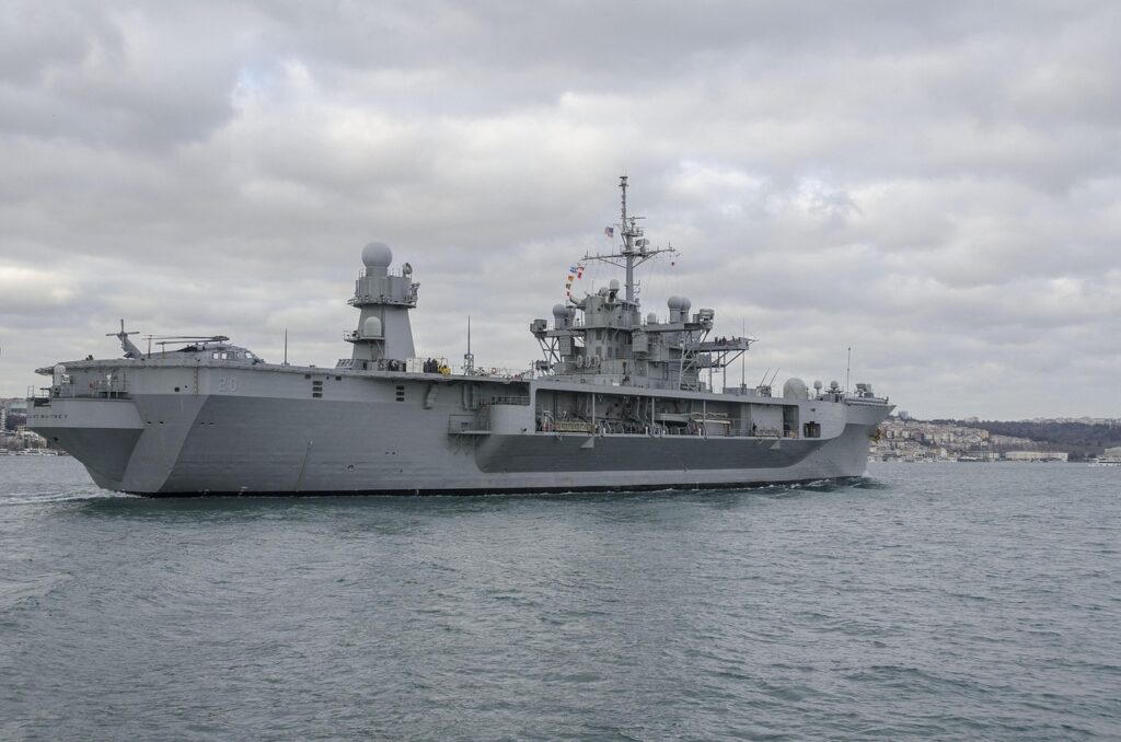
Beyond its local life, the Bosphorus is one of the busiest and most difficult shipping channels in the world. Its narrowness, its sharp turns, and its strong currents make it a test of seamanship, and its traffic includes not only ferries and fishing boats but container ships, cruise liners, and tankers.
The passage of oil tankers through the strait has made the Bosphorus a matter of global concern. The waterway carries a significant share of the world’s energy trade from Black Sea ports to world markets, and an accident in the strait could threaten the heart of Istanbul itself.
Navigation is governed by international treaty and managed by Turkish authorities, and the strait’s pilots guide the largest vessels through its turns. The tension between the strait’s role as a local river for the city and a global highway for the world is one of the permanent dramas of the Bosphorus.
Life on the Water Today
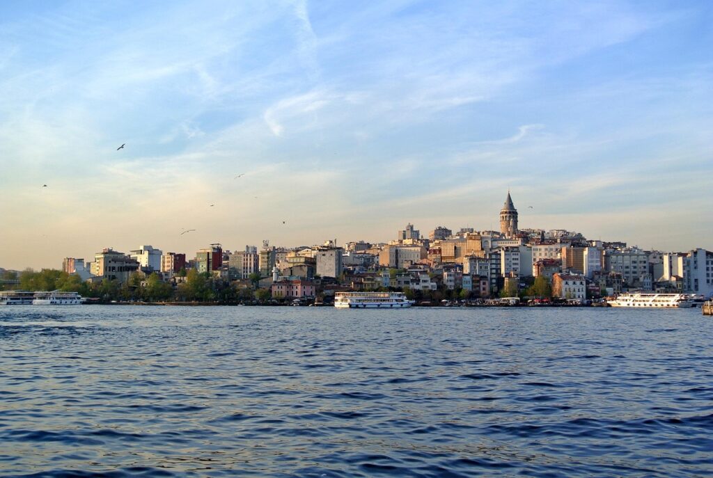
The Bosphorus today is the stage of Istanbul’s public life. Its waterfront promenades fill with families on weekends, its fish restaurants and tea gardens line the shores, and its waters carry everything from fisherman’s boats to the racing shells of rowing clubs at dawn.
The strait remains a working body of water as well. Commercial fishing continues, and the night boats with their lights still chase the bluefish that migrate through the strait with the seasons, following a rhythm of currents and fish that predates the city itself.
The modern threats are also visible: the shipping traffic, the pollution of a megacity, and the pressure of development along the shores. Protecting the Bosphorus has become an environmental cause with wide public support, and the strait’s health is treated as a matter of national pride.
Why the Bosphorus Still Matters
The Bosphorus matters because it is the reason Istanbul exists at all. Without the strait there would be no city, no empire, no crossroads of civilizations, only a quiet coast on either side of a river of a different kind. The strait is not a backdrop to the city’s history; it is the source of it.
The strait also matters as a symbol. It is the meeting of Europe and Asia, of the Black Sea and the Mediterranean, of East and West, and it gives Turkey one of its most powerful images: a city on two continents, looking in both directions at once.
For the visitor, the message is simple. However long you spend in Istanbul, spend some of it on the water. The ferry crossing, the boat tour, even the bridge at sunset, will show you the city whole in a way that no monument or museum can match, because the city’s entire story is written in the current beneath you.
Frequently asked questions
How long is the Bosphorus?
The Bosphorus is approximately thirty kilometers long, running from the Black Sea in the north to the Sea of Marmara in the south. Its width varies from several kilometers at its widest point to less than a kilometer at its narrowest, and its depth reaches well over one hundred meters in places, making it one of the world’s most dramatic urban waterways.
Can you swim in the Bosphorus?
Swimming is possible, and organized swimming events cross the strait every year, but casual swimming is not recommended for most people. The currents are strong, the double-layered flow is hazardous, and the shipping traffic is intense. There are better options: the beaches and bays of the Prince’s Islands and the Black Sea coast offer safer swimming within reach of the city.
What is the best way to see the Bosphorus?
The classic answer is the ferry. The commuter ferry along the Bosphorus line runs the full length of the strait, passing the palaces, fortresses, and villages of both shores, and it costs no more than ordinary public transport. Private boat tours offer commentary and stops, while the bridges and the waterfront parks give excellent land-based views at sunset.

All Over Information
The All Over Information editorial team researches and writes practical English-language guides to Turkey. Facts are checked against official and local sources before publication, prices are published as dated ranges rather than quotes, and guides are revised when things change. We accept no sponsored posts, paid placements or paid links.
More guides like this

Luxury Resorts in Bodrum and Antalya
Turkey's southwest coast is one of the great luxury travel destinations of the Mediterranean, and its two most famous names are Bodrum…
Turkey’s National Sovereignty and Children’s Day
Every April 23, Turkey celebrates a holiday that exists nowhere else in the world: a national day given entirely to children.
Turkish Scholarship Programs for Foreign Students
Turkey funds one of the most generous scholarship systems in the world for foreign students, and you do not need to be…

Turkey’s Best Spa and Wellness Retreats
Turkey is a country built on wellness traditions.
Turkey’s Best Sunset Spots
Turkey sits between two seas and a mountain range, and its geography produces sunsets that photographers plan whole trips around.

How to Book Turkish Intercity Buses
The intercity bus is the backbone of travel in Turkey.