Sariyer’s history is written in water and stone. The Bosphorus made the district, bringing the Greeks, the Byzantines, and the Ottomans to its shores; the fortress at the narrow strait defended the city; and the forest behind it supplied the water that kept the capital alive. This guide tells the district’s story in layers, from the first fishing villages to the modern suburbs, and shows you where the history is still visible today, in the fortresses, the wooden mansions, and the daily life of the working waterfront, where the past is not excavated but simply continued.
A District Built by the Water
Sariyer has always been a place of the water, and its story begins at the waterline. The Bosphorus villages grew from fishing communities that anchored their boats in the sheltered bays, and the strait was the highway that connected them to the wider world, carrying their fish and their fortunes.
The name of the district speaks of the landscape: the yellow soil and the open ground of the northern shore, which gave the place its identity before any empire noticed it. The villages that line the coast were separate little worlds for centuries, each with its own pier, its own boats, and its own character, knitted together only by the water.
The water still defines the district, and the daily rhythm still follows the tide and the timetable. The ferries follow ancient routes, the fishermen work the same waters, and the villages still turn their faces to the strait, as they always have, with their backs to the road that came later.
The Name and Early Days
The name Sariyer comes from the Turkish for yellow place, a reference to the pale soil and hills of the northern shore. The district’s history, however, runs much deeper than the name.
The shores of the Bosphorus were settled in antiquity, and the northern villages sat along the trade routes between the sea and the city, at the point where the strait widens into open water. Fishing, trade, and the movement of ships shaped the settlements from the earliest days, and the current of history flowed past their piers.
Through the Byzantine centuries, the region served as a rural hinterland, feeding the city with its harvests and guarding its sea approaches from the north. The pattern of villages and piers that survives today, strung along the coast like beads, has roots in that ancient arrangement of watch and trade.

Rumeli Hisarı and the Conquest
The defining moment of the district’s history came in the fifteenth century, when the great fortress of Rumeli Hisarı rose on the narrowest point of the strait, opposite the older castle on the Asian shore, in a matter of months and with an army of builders.
The fortress was built in a matter of months, on the eve of the conquest, and it gave the Ottomans command of the strait, cutting the city off from its supplies and sealing its fate. Its towers still stand today, among the best preserved in the region, and they look exactly as they must have looked to the ships below.
Standing on its ramparts, you see the same narrow channel the conquerors saw, and the same strategic brilliance that the fortress embodies, the strait reduced to a defensible ribbon of water. The building is the district’s most powerful history lesson, and it teaches without a single word.
Yalıs and the Bosphorus Villages
In the Ottoman centuries, the Bosphorus became the playground of the empire, and its northern reaches became the summer address of the powerful. The sultans and the high officials built their wooden mansions, the yalıs, along the shore, and the villages of the northern strait grew into elegant retreats where the court escaped the heat of the city.
Villages like Yeniköy, Tarabya, and Büyükdere became fashionable, with their waterside mansions, their gardens, and their summer society of ambassadors, artists, and statesmen. The great wooden houses that survive today, with their carved facades and their garden walls, are the heirs of that golden age.
The yalıs turned the northern shore into a ribbon of wood and water, the most beautiful shoreline in the empire, and the villages kept their fishing life beneath the elegance. That double character still defines the district: grandeur at the water’s edge, hard work just behind it, and the two living comfortably side by side.
The Belgrade Forest: Water for the City
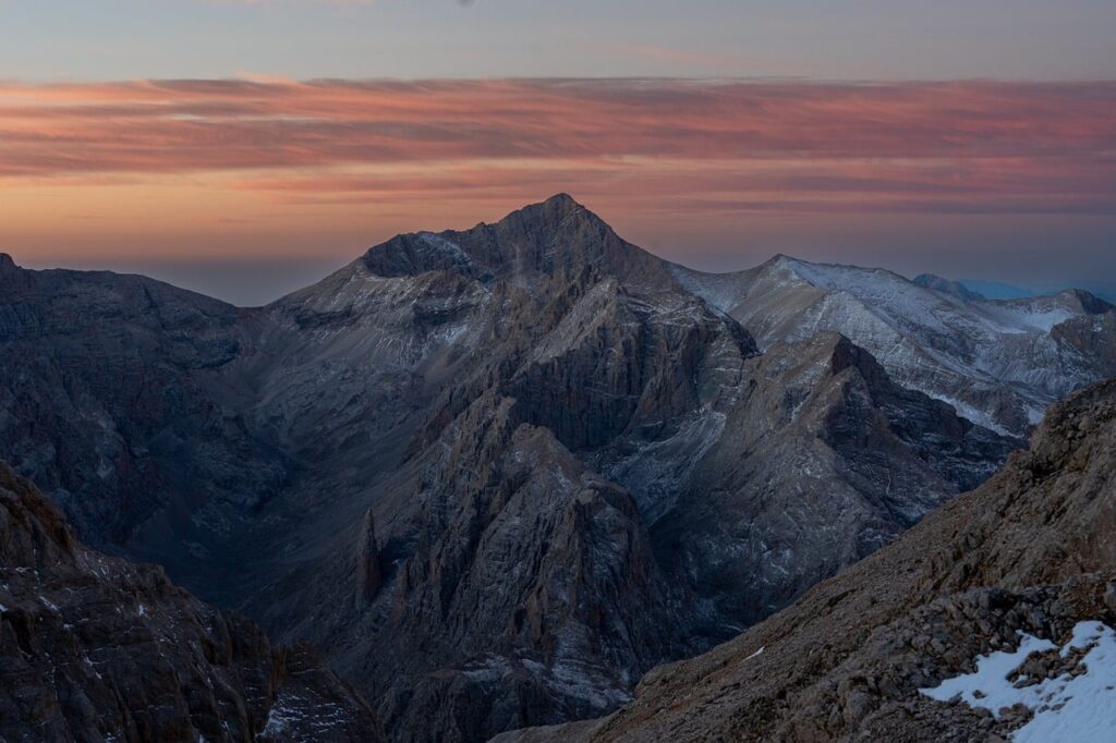
Behind the coast, the Belgrade Forest holds one of the great engineering stories of Ottoman Istanbul, a hidden counterpart to the visible monuments. For centuries, the forest’s springs and streams were channeled to supply the city’s water, through dams, aqueducts, and underground conduits, and the system ran for hundreds of years.
The system was begun in the sixteenth century and expanded for generations, and the great stone aqueducts still stride across the valleys like monuments to a vanished state. They are the hidden history of the district, waiting among the trees for the walkers who find them, and they reward every step of the search.
Walking to the old dams is to walk the spine of an empire’s infrastructure, with every valley a reservoir and every ridge a conduit. The forest, which looks so wild, is in fact one of the oldest engineered landscapes in the region, and its wildness is only the patina of centuries.
Fishing Traditions
The fishing life is the district’s oldest culture, and it survives intact in a way that few traditions do. The boats still put out from the same piers at the same hour, the nets still hang in the same lines, and the market still opens with the catch, exactly as it did a century ago.
The fish of the Bosphorus and the Black Sea shaped the district’s food, its economy, and its identity, and the silver harvest still drives its seasons. The seasonal runs of anchovy and bonito still set the calendar of the northern shore, marking the months the way the weather does.
The fishermen are the guardians of the district’s soul, and their work is the thread that connects the ancient village to the modern town, unbroken across the centuries. Watch them long enough, and you see the whole history in the daily routine: the nets, the tides, the patience, and the pride.

Shrines and Local Devotion
The religious life of the district is woven into its villages, as quietly as the faith itself. The mosques of the coast and the forest edge have served their communities for centuries, and the shrines of the region hold the local legends, passed from grandmother to grandchild.
The shrine of Telli Baba, above Tarabya, is the district’s most beloved: a place of wishes and candles, where generations have come with their hopes. The legends of the saint are told with a smile and a belief.
The devotion of the district is quiet, personal, and constant, and it asks nothing of the passerby. The shrines and the mosques are not monuments for tourists; they are the working faith of a working community, and the visitor who understands that will be welcome in all of them.
The Republican Era and Modern Growth
The twentieth century changed Sariyer as it changed the whole country. The district grew from a chain of villages into a suburb, with new roads, new schools, and new neighborhoods climbing the hills.
The fishing and the forest remained, but the city arrived: commuters, businesses, and the slow spread of the metropolis to the very edge of the sea. The district became both a gateway and a getaway.
Today Sariyer balances its roles: a home for hundreds of thousands, a day-trip destination, and a keeper of the old ways. The modern district carries its history lightly, but it carries it everywhere.

Culture Today
The culture of Sariyer today is a living thing. The museums of the coast preserve the collections of the mansions, the festivals of spring draw the city to the parks, and the village traditions survive in the market and the tea garden.
The district’s identity is still built on the water: the ferry commute, the fish dinner, the Sunday promenade. These are not traditions preserved in glass; they are the rhythms of daily life.
For the visitor, the culture is found by participation: a tea in the village, a walk on the pier, a morning at the market. The district’s history lives in its present, and it welcomes the curious in.
How to Experience the History
The history of Sariyer is best experienced in order. Start at the fortress of Rumeli Hisarı, the great set piece, then ride the ferry north through the village chain, seeing the yalıs as the Ottomans did, from the water.
Walk the forest to the old waterworks, and let the engineering of the dams sink in. Then end at the working harbor, watching the fishing life that has anchored the district’s identity from the beginning.
Give the history two days if you can, and let each layer settle before the next. Sariyer rewards the visitor who reads it like a book, one page at a time.
Frequently asked questions
What is the most important historical site in Sariyer?
Rumeli Hisarı, the great fortress on the narrowest point of the Bosphorus, is the district’s most important monument. Built on the eve of the city’s conquest, it changed the course of history by giving the Ottomans command of the strait. Its towers and ramparts survive in excellent condition, and it is both a masterpiece of military engineering and a beautiful place to visit.
How did the Belgrade Forest shape the district?
The forest was the waterworks of Ottoman Istanbul. For centuries, its springs and streams were captured by dams and carried to the city by aqueducts, some of which still stand among the trees. The forest shaped the district’s economy, its settlement pattern, and its very identity as the green, northern edge of the city.
Where can I see the old Bosphorus culture?
The villages of the coast, especially Yeniköy and Tarabya, still show the wooden mansions and the waterside life of the Ottoman era, best seen from the ferry. The working harbor, the fish market, and the shrines such as Telli Baba keep the older traditions alive. The museums of the northern shore preserve the collections of the old families.

All Over Information
The All Over Information editorial team researches and writes practical English-language guides to Turkey. Facts are checked against official and local sources before publication, prices are published as dated ranges rather than quotes, and guides are revised when things change. We accept no sponsored posts, paid placements or paid links.
More guides like this

Best Local Restaurants in Sariyer
The food of Sariyer is the food of the water: fresh fish, meze, and the famous flaky pastry called Sariyer böreği.
Sariyer in Summer: A Complete Travel Guide
Summer is when Sariyer comes into its own.

Sariyer in Winter: What to Expect
Winter is Sariyer's secret season. The ferries still run, the fish restaurants are at their busiest, the forest turns quiet and beautiful,…
Sariyer Airport and Transport Guide
Getting to Sariyer is a journey across the whole of Istanbul, and knowing the transport options turns that journey into part of…

The Best Day Trips from Sariyer
Sariyer makes a wonderful base for exploring the northern edge of Istanbul, because the district itself is the start of every good…

Hidden Gems of Sariyer Most Tourists Miss
Every guide to Sariyer mentions the ferry, the fish restaurants, and the forest, but the district keeps its best secrets a little…